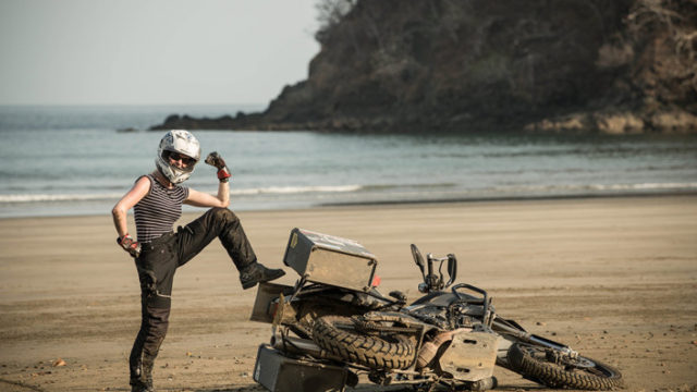
If you’re planning on visiting Argentina, Chile and Bolivia – here’s our ‘Top Ten’ offbeat travel hot spots
The southernmost city in the world, Ushuaia is the capital of Tierra del Fuego, Antártida e Islas del Atlántico Sur Province, Argentina. After some incredible hiking in this PATA-God-of-Peaks-GONIA, you surely won’t forget to have your photograph taken at the ‘Fin del el Mundo’ (End of the World) sign in Tierra del Fuego National Park – you may even spot a Fuegian red fox! While you’re there, why not indulge in a traditional asado with cordero (a barbeque with Patagonian lamb), visit the Harberton Estancia to learn all about missionary pioneer Tommy Bridges and the inspiring biologist Natalie Prosser whose museum she founded is home to some of the world’s finest specimens of whale, dolphin and other marine life. It would also be a missed opportunity not to visit the Ushuaia’s museums and immerse yourself in the lives of the Yámana and other Indian tribal peoples that lived in harmony for centuries.
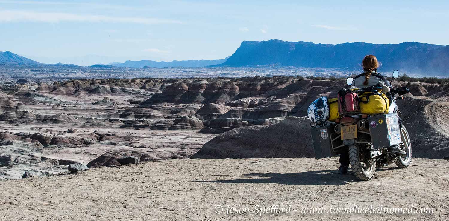
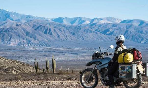
Ischigualasto Provincial Park, also called Valle de la Luna is a provincial protected area in the north-east of San Juan Province, north-western Argentina, limiting to the north with the Talampaya National Park, in La Rioja Province. Valley of the moon is a 630 square km UNESCO park, a desert valley that sits between mountain ranges Cerros Colorados in the east and Cerro Los Rastros in the west.
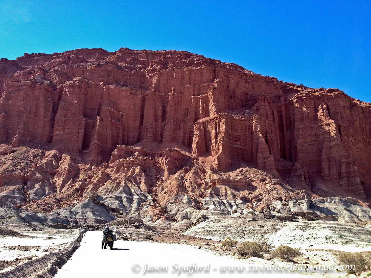
We rode into a sandy scene of cacti and rock formations steeped in rich mineral layers: creamy white calcium, pistachio green copper, bile yellow sulphur and terracotta-tinged iron, which looked super-imposed against a cloudless blue sky. During a 40 km paid tour on us astride our bikes following a procession of cars, we listened intently to how complete specimens of dinosaur skeletons had been found from the Triassic period, preserved so perfectly inside the layered sedimentary rock infused with its safeguarding substances. Fortunately, our tour guide Florencia was relaxed and allowed us to hang back, disappearing from view more oft than not and foremost the throng of tourists.
Over millennia at every meander in the canyon, the waters of the dry River Ischigualasto had carved shapes in the malleable red sandstone, monochrome clay and volcanic ash. I didn’t think much to the ‘submarine’ or ‘worm’ but rather liked the ‘Sphinx’ with an uncanny resemblance to a lion’s body wearing a woman’s head. It was an incredibly raw remnant of the Mesozoic Era, representing an ancient segment of our evolution. Riding around the place on two wheels was a fittingly first rate way to see the place although four wheels would suffice just as well.
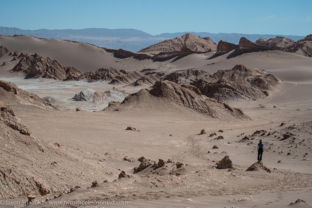
The Atacama Desert is a plateau in South America, covering a 1,000 km strip of land on the Pacific coast, west of the Andes mountains. It is the driest non-polar desert in the world. San Pedro de Atacama makes an ideal base for daily sorties including: Salar de Talar, Valley of the Moon, Laguna Chaxa – a flamingo breeding site, Laguna Cejar and Laguna Tebinquinche near Ojos del Salar sinkholes and ‘The Indian Stone’, a geological monolith, near Salar de Tararock. There’s a wealth of wonderful sights to see in the Atacama, the place really got under our skin and it was a wrench to leave.

El Tatio is a geyser field located within the Andes Mountains of northern Chile at 4,320 meters above sea level. Its name means ‘the grandfather’. It is among the highest-elevation geyser fields in the world. You’ll be in geyser seventh heaven here. Fumaroles bubble all over the geyser field, plumes of scalding hot water gush upwards and arresting towers of steam rise from the rocks making a spectacular sight. There’s even a hot spring you can warm up your cockles in, it’s bliss. Just beware of early morning temperatures, which can go as low as -20 degrees Celsius! No one had a problem with us taking our wheels down onto the geyser field, we stayed mostly on the designated paths – what a rare ride out of the norm!

Salar de Uyuni is the world’s largest salt flat at 10,582 square km. Need I say more? It is located in the Potosí and Oruro departments in southwest Bolivia, near the crest of the Andes and is at an elevation of 3,656 metres above sea level. Superlatives are not needed for this astounding site…

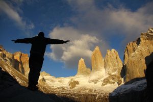
Torres del Paine National Park is a national park encompassing mountains, glaciers, lakes, and rivers in southern Chilean Patagonia. What more could you ask for? The Cordillera del Paine is the centerpiece of the park. Hike the ‘W’ trail to get an intimate encounter with ‘The Horns’ and ‘The Towers’ but be warned, it’s an intense five day footslog of around 70 km. You may want to opt for the full ten day circuit, which lots do and love. Without stating the obvious, a

decent backpack and proper hiking boots are essential, I’d say so are dry bags too to hang your food in nearby trees when camping away from the pesky mice! The vistas however will have your soul singing so it’s worth the strenuous effort. Pack plenty of high-energy (lightweight) foods and second skins for those blisters.
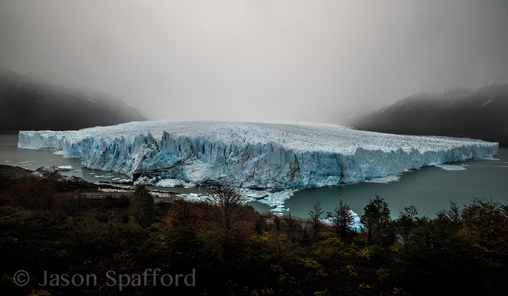
The neck-craning, jaw-dropping Perito Moreno Glacier is a glacier located in the Los Glaciares National Park in southwest Santa Cruz province, Argentina. It’s iconic and staggeringly beautiful that will send your heart soaring. The 250 km2 ice formation and 30 km in length, is one of 48 glaciers fed by the Southern Patagonian Ice Field located in the Andes system shared with Chile. This icefield is the world’s third largest reserve of fresh water. The Perito Moreno glacier, located 78 km from El Calafate, was named after the explorer Francisco Moreno, a pioneer who studied the region in the 19th century and played a major role in defending the territory of Argentina in the conflict surrounding the international border dispute with Chile.
The magnificent Monte Fitz Roy is a mountain located near El Chaltén village, in the Southern Patagonian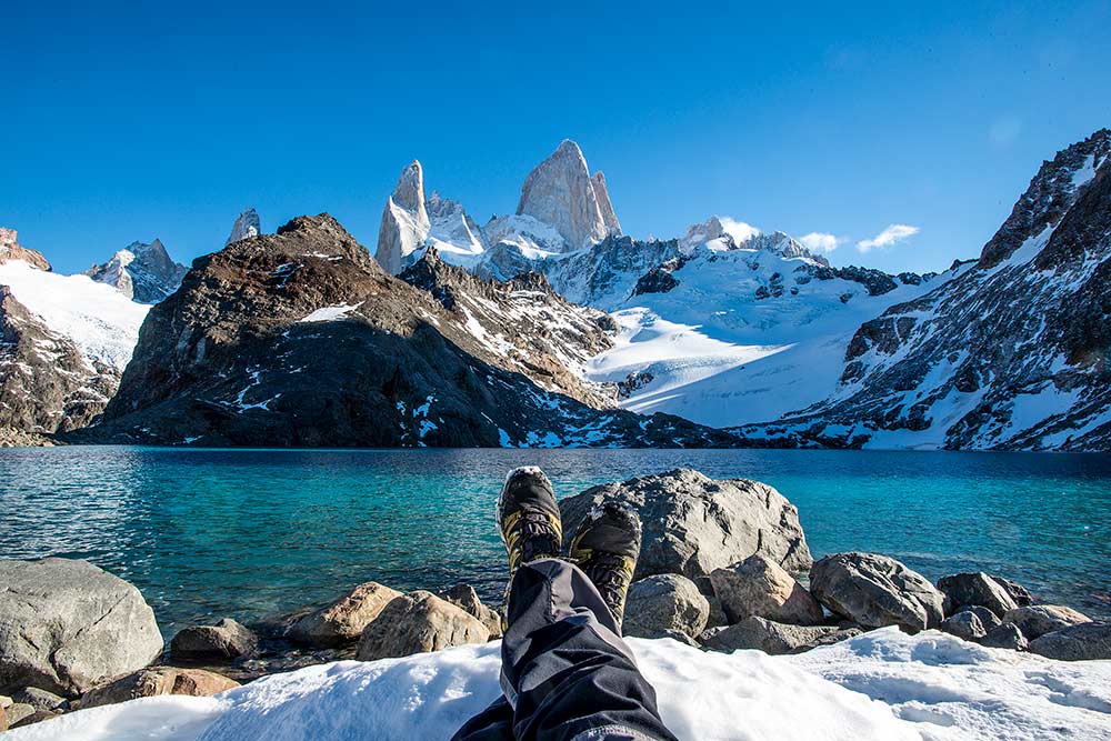 Ice Field in Patagonia, on the border between Argentina and Chile.
Taking a pre-dawn hour-long hike up to Lake Capri will give you a good warm-up. It facilitates a rich opportunity to watch the sun rise over Mount Fitz Roy from afar, part of the Southern Patagonian Ice Field. We stayed until the first light bathed the tip of the peak at over 3,400 metres; its meringue smooth snow was the whitest I’d ever seen. It was bitterly cold in May 2014 first thing but the German, Dutch and Argentinian trio of chaps accompanying us agreed, it was well worth the chilly 14 km walked.
If you’re anything like us, you’ll be itching for a closer look. The two of us took the 25 km round trek over to Laguna de Los Tres. This was about the closest we were going to get to Mount Fitz Roy, which afforded the most intimate vantage point overlooking the lagoon. As soon as we’d caught our breath from the slog endured to climb up there, the sight took our breath away once more. The lagoon was incredible, so clear and gorgeous – it was all I could do not to leap into those placid waters. Mother have mercy though, we were walking on hot coals for the last ten miles to get back – plodding heavily down unforgiving stones salted with white on the snow-speckled trail. These peaks of Patagonia certainly make you earn it.
Peeling ourselves away from El Chaltén, we rode alongside the sun-flecked waters of Lago Argentina for what seemed like an eternity. This lake was at least fifty miles long. As sure as eggs are eggs though, the smooth tarmac gives way to more interesting gravelly terrain shortly before Lago Cardiel. Enjoy!

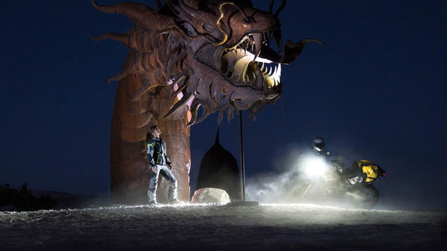
The Mano de Desierto is a large-scale sculpture of a hand located in the Atacama Desert in Chile, 75 km to the south of the city of Antofagasta, on the Pan American Highway. The nearest point of reference is the “Ciudad Empresarial La Negra”. A spectacular sight to behold at 11 metres high. It looked like a last vestige of a lost civilization. The entity as a whole put back an artful finesse into the striking sculpture that the mindless scribblings had tried to take away. Mario Irarrázabal the sculptor, symbolised the enigmatic sculpture as a sorrowful sentinel intended to evoke the tragic reality of the human condition. Emotions such as injustice, loneliness, human vulnerability and helplessness are embodied, it’s striking and unique.

As a flyspeck town in the Tumbaya Department of the Jujuy Province, Purmamarca we re-labelled ‘Permanent marker’ is no broader than the tip of one. It sits against Cerro de los Siete Colores – the Hill of Seven Colours, which can only be described as a jagged rock formation resembling the marzipan fantasy of an over-zealous pastry chef. The village makes its coin by the congruent rainbow of colours interlaced through woven goods and handicrafts on offer. You could buy anything from a hat, poncho and slippers with a matching hippy handbag. A straggle of ochre adobe houses and age-old algarrobo trees next to a bijou 17th century church surrounded the hubbub of the central plaza. I loved weaving around the hills to get a better look at the place, coming away from the hordes of holiday-makers for a more relaxing ride by ourselves to just well, soak it all up.